0R15 8734.0 -2.0852% 0R1E 8176.0 -1.005% 0M69 None None% 0R2V 228.48 -0.4444% 0QYR 1467.5 1.5922% 0QYP 413.93 -2.6047% 0RUK None None% 0RYA 1512.0 -4.0% 0RIH 172.95 0.0% 0RIH 175.0 1.1853% 0R1O 200.94 9798.5222% 0R1O None None% 0QFP 5040.0 0.0% 0M2Z 259.5949 -0.662% 0VSO 32.5 -8.7207% 0R1I None None% 0QZI 559.0 0.0% 0QZ0 220.0 0.0% 0NZF None None% 0YXG 165.6469 0.0998%
World news
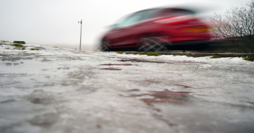
Yellow warnings for ice across north of UK

Image Source: PAMEDIA
Yellow warnings for ice are in place across Scotland, Northern Ireland and much of northern England tomorrow, while the rest of the country is likely to be fine or cloudy.
The warnings are in place until 11am on Monday with forecasters highlighting the risk of injuries from slips and falls, as well as icy patches on some untreated roads, pavements and cycle paths.
The Met Office said: “Following recent wet conditions, surfaces are likely to remain wet into Monday morning and, with a cold night, icy stretches will readily form on untreated surfaces.
“A few rain, sleet and snow showers may still affect these areas overnight, but ice remains the main hazard.”
Travel in the north has already been disrupted by flooding. Network Rail said a landslip had collapsed an embankment along part of the West Coast Mainline and it has closed the track between Carlisle and Glasgow until January 6 to conduct repair works.
All flood warnings in Scotland have now lifted but some are still in place around York, East Sussex, Bournemouth, Bristol and the Lake District.
However for much of the UK, Monday is likely to be the driest day of the week with rain moving in from the Atlantic afterwards, forecasters said.
Met Office meteorologist Dan Stroud said: “The rest of the UK, certainly a colder night than the night just gone… a few showers moving off of the north and west around Liverpool Bay area across the Lake District, and those will leave behind wet surfaces during the course of the afternoon and into the evening.
“So we’re expecting temperatures to get low enough for a few icy stretches to develop by around midnight across parts of Northern Ireland and northern England.
“The big thing tonight, most people will notice across England and Wales, is it will feel colder than it has done the last few nights. We’re looking at temperatures into mid-single figures with a rural frost possible in parts of Wales, for example.
“There’s the risk of some icy stretches around, so definitely anyone out early tomorrow morning just needs to take some care.
“We’re expecting a lot of wet weather as we move into the working week.
“The best day of the week is probably going to be Bank Holiday Monday, with a lot of dry and generally fine weather across the country, a bit of a cloud in the mix, with cloud and rain moving in early Tuesday morning.
“And then our focus gets to a spell of wet weather (on) Tuesday into Wednesday and that could produce quite a bit of rain across some western locations.”